
by lead Artist Sam McKinney

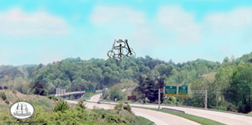
Graphic of proposed Heritage Monument viewed from the Bert T. Combs Mountain Parkway traveling east approaching Exit 43
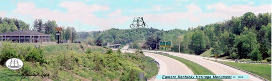
Panoramic view of proposed Heritage Monument as seen from the Quillen's Chapel Bridge on the Mt. Parkway
Aerial View graphic of proposed Heritage Monument elements. This view is superimposed over a topographic map of the proposed location. This allows a proper perspective of how the elements fit into the natural geography of the land.
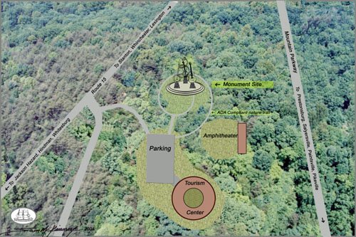
Note: The overall vision has expanded to include the adjacent 15 acres to the east of the original proposal. This property has approximately 5 acres of bulldozed level ground. This would provide ample space for parking, better access, and a ready-made site for the Information/Celebration Center.
The Logo
![]()
Visit Sam's web site at :